Active filter
- Search for "START"
- Sort by "Best results"

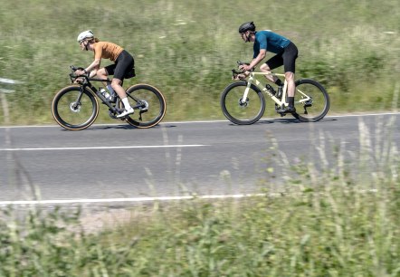
Racing bike marathon 124 km
Lenght: 129.1 km
Route: Sarresdorfer Straße, 54568 Gerolstein to Sarresdorfer Straße, 54568 Gerolstein
Difficulty: difficult
Round trip, Public transportation

Road bike tour 44 km
Lenght: 45.2 km
Route: Gerolstein town centre - Tourist Information, Bahnhofstraße 4, 54568 Gerolstein to Gerolstein town centre - Tourist Information, Bahnhofstraße 4, 54568 Gerolstein
Difficulty: medium
Round trip, Public transportation

Stadtkyll hiking trail SY 4
Lenght: 14.9 km
Route: Information board at the church square, Hauptstr., 54589 Stadtkyll to Information board at the church square, Hauptstr., 54589 Stadtkyll
Difficulty: medium
Round trip, Public transportation

Tieferbach path
Lenght: 4.4 km
Route: Bus stop town centre, 54578 Oberbettingen to Bus stop town centre, 54578 Oberbettingen
Difficulty: medium
Round trip, Public transportation

Volcano Trail
Lenght: 13.3 km
Route: Tourist-Information, Am Markt 1, 54576 Hillesheim to Tourist-Information, Am Markt 1, 54576 Hillesheim
Difficulty: medium
Round trip, Public transportation

Waterfall - Round
Lenght: 10.3 km
Route: Reservoir car park, end of Bachstraße, 54578 Kerpen to Reservoir car park, end of Bachstraße, 54578 Kerpen
Difficulty: medium
Round trip, Public transportation

Zähbasaltweg (Tough basalt trail)
Lenght: 7.1 km
Route: Community centre Hohenfels-Essingen, corner Schulstraße/ Auf Erd, 54570 Hohenfels-Essingen to Community centre Hohenfels-Essingen, corner Schulstraße/ Auf Erd, 54570 Hohenfels-Essingen
Difficulty: medium
Family-friendly, Round trip, Public transportation

Bahnhof - Lissendorf
Lissendorf
The station in Lissendorf is located on the Eifel route Köln-Trier and is an ideal starting point for those who arrive without a car.
More information
Adventure hike Birresborn ice caves
Lenght: 5 km
Route: Town centre 54574 Birresborn to Town centre 54574 Birresborn
Difficulty: easy
Family-friendly, Round trip, Public transportation

Birgel Wanderweg LB 4
Lenght: 7.1 km
Route: Car park at the Birgel community centre, Wiesbaumer Str. 1, 54587 Birgel to Car park at the Birgel community centre, Wiesbaumer Str. 1, 54587 Birgel
Difficulty: medium
Family-friendly, Round trip, Public transportation

