Active filter
- Search for "Land"
- Sort by "Best results"

Eifel Tour App
More information
Eifelsteig Stage 05
Lenght: 17.5 km
Route: Am Marienplatz, 54673 Gemünd to Hermann-Josef-Straße 4, 53925 Kloster Steinfeld
Difficulty: medium
Public transportation

Eifelsteig Stage 09
Lenght: 22.3 km
Route: Busbahnhof, Viehmarktplatz, 54576 Hillesheim to Am Bahnhof, 54568 Gerolstein
Difficulty: medium
Public transportation

Eifelsteig Stage 10
Lenght: 23.7 km
Route: Am Bahnhof, 54568 Gerolstein to Am Bahnhof, Stadtparkhaus, 54550 Daun
Difficulty: difficult
Public transportation

Contact & opening hours
More information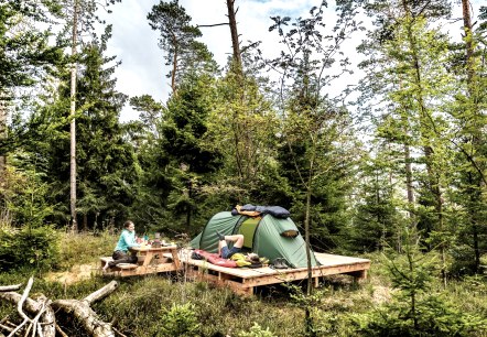
Trekking sites in the Eifel
Camping in nature is permitted at official trekking sites.
More information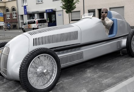
BIRTH OF THE “SILVER ARROW” | Silberpfeil Nürburgring
BIRTH OF THE “SILVER ARROW” How did the “Silver Arrow” get its name and where did it come from? – In 1934, the new weight regulation, known as the “750 kg formula”, came into force in the World Championships that year. Vehicles without petrol, oil, coolant, and tyres were not permitted to exceed this weight…
More informationImpressum
More information
Privacy Policy
More information
Eifelsteig Stage 07
Lenght: 17.7 km
Route: Zentrum am Rathaus 53945 Blankenheim to Parkplatz Haus Mirbach, 54578 Mirbach
Difficulty: medium
Public transportation